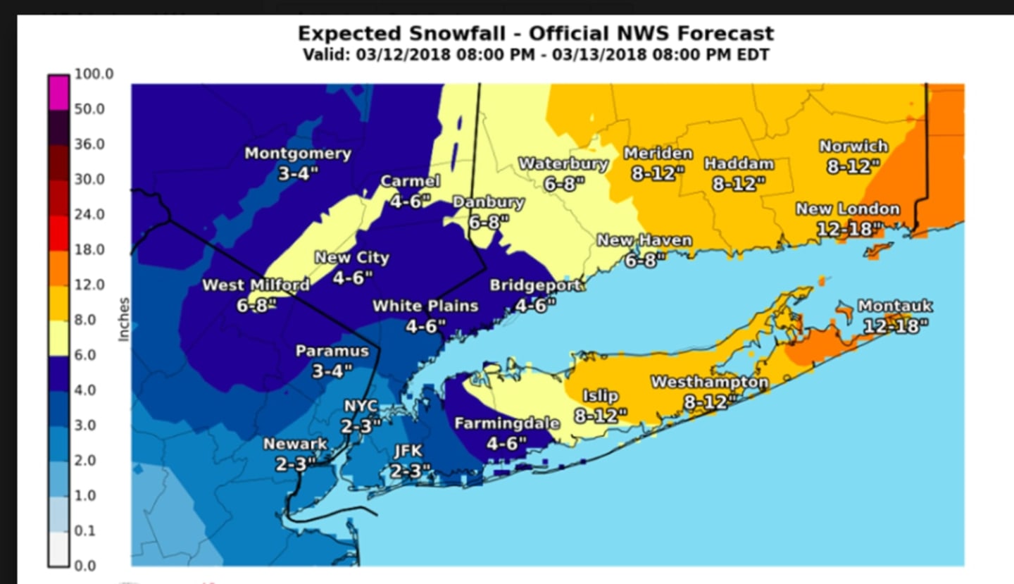
Snowfall at rates of an inch or more an hour will continue to be possible through late morning. Snowfall accumulations in the tristate area will range from 3 to 8 inches. (See latest projections from the National Weather Service in the image above.)
The heaviest snow is expected to wrap up by noontime Tuesday.
A Winter Storm Warning is in effect for Fairfield County until 6 p.m. Tuesday. A Winter Weather Advisory is in effect for the entire Hudson Valley as well as Bergen and Passaic counties until noon Tuesday.
Snow is expected to taper off early in the afternoon, but remain possible at times through 9 p.m. The temperature will rise to mid-30s but winds of 17 to 20 mph with guys as high as 32 mph will make it feel more like it's between 20 and 25 degrees.
Snow, mainly before 3 p.m. High near 37. Wind chill values between 20 and 25.
The overnight low will be in the upper 20s under mostly cloudy skies.
There is a chance of morning snow showers Wednesday on what will be a cloudy and windy day with a high around 40. Wind chill values will between 15 and 25 with gusts as high as 30 mph.
Thursday will be a partly sunny day with a high in the low 40s.
Check back for Daily Voice for updates.
Click here to follow Daily Voice Pelham and receive free news updates.