The quick-moving storm moving through the area Saturday night into Sunday morning could bring up to 6 inches of snowfall to parts of the area with more accumulation now expected farther south than earlier projected.
A Winter Storm Watch is in effect for the Hudson Valley, northern New Jersey and Fairfield County from 7 p.m. Saturday to 7 a.m. Sunday.
Motorists should plan on difficult travel conditions. Significant reductions in visibility are possible. Isolated power outages due to the weight of snow are also possible.
Saturday will be sharply colder during the day with a high in the low- to mid-30s and sun mixed with clouds during the day.
Low pressure will approach our area from the southwest, passing south and east Saturday night, with snow developing late Saturday night, the National Weather Service said.
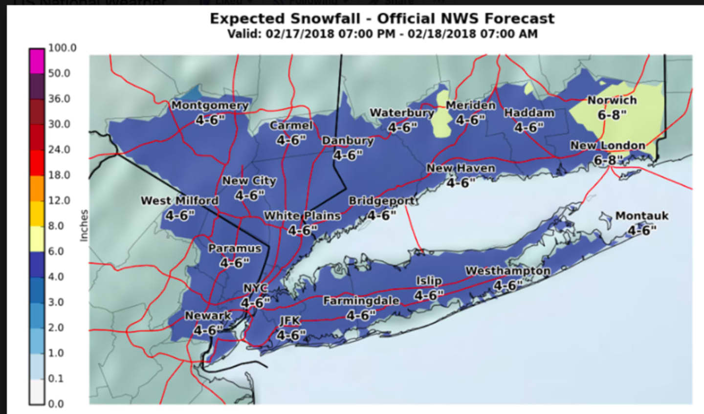
Snow will begin to fall at or shortly after nightfall Saturday, between 6 p.m. and 8 p.m. throughout the area, and continue until sometime between 2 a.m. and 5 a.m. Sunday, with 4 to 6 inches of accumulation expected for most of the area. (See image above.)
A shift in the storm track, the amount of mixing along the coast and location of any snow band could result in changes in the amount of snowfall.
Sunday will start off cloudy before becoming mostly sunny with a high in the mid-40s.
Check back to Daily Voice for updates.
Click here to follow Daily Voice Pelham and receive free news updates.