Snow is expected to arrive sometime after 11 p.m. in most of the area. The overnight low will be between 20 and 22 degrees. Accumulation of around an inch is possible overnight, according to the National Weather Service, in a Special Weather Statement.
The window for possible snow will continue until around 9 a.m. Friday with another inch or slightly more of accumulation possible.
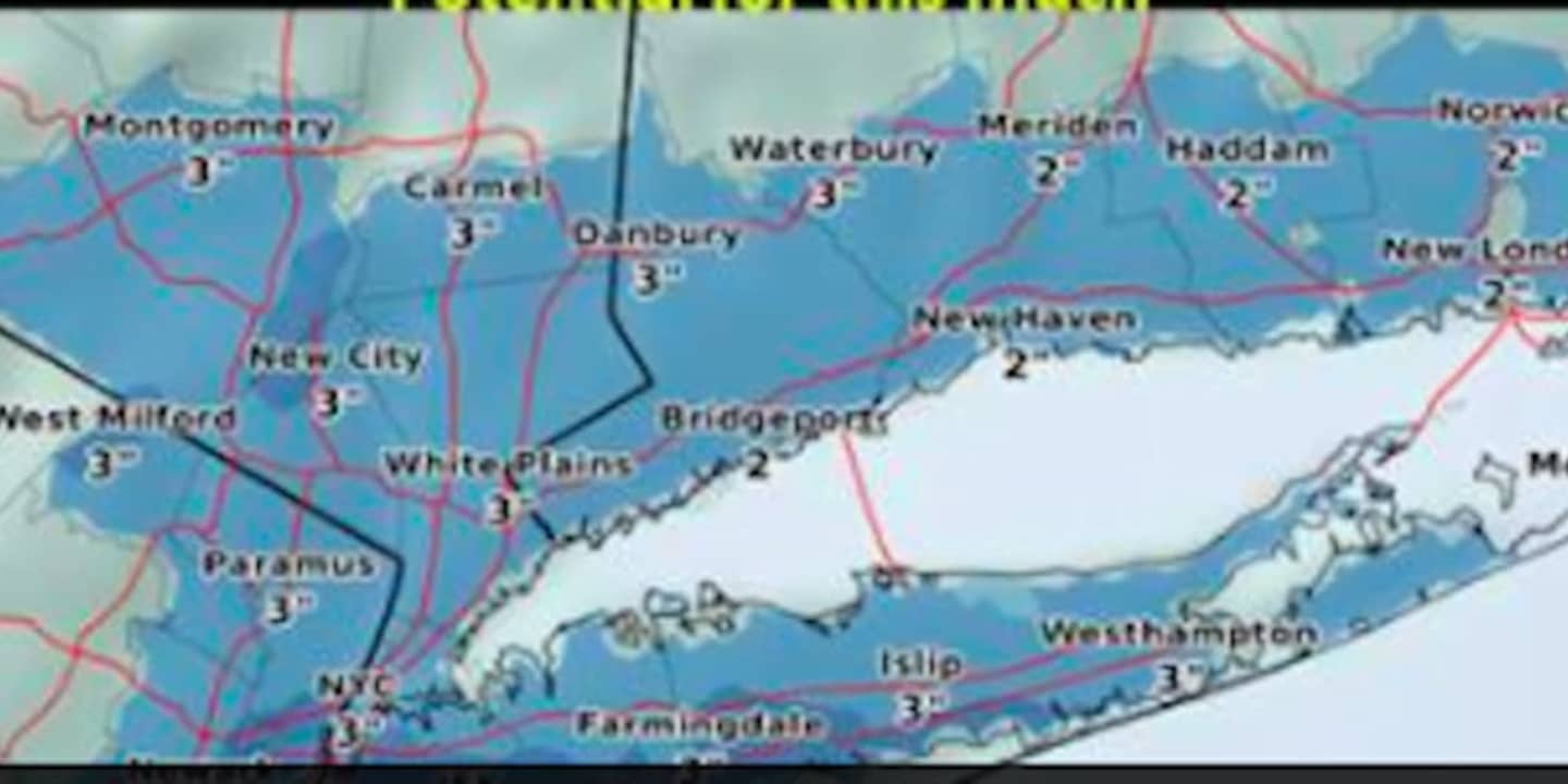
There is the potential for some parts of the area to see as much as 3 inches of accumulation, according to the National Weather Service. (See chart above.)
The rest of the day will be mostly cloudy with a high around freezing but the wind-chill factor making it feel more like it's between 20 and 25.
Saturday will be partly sunny and brisk with a high n the upper 20s.
Check back to Daily Voice for updates.
Click here to follow Daily Voice Pelham and receive free news updates.